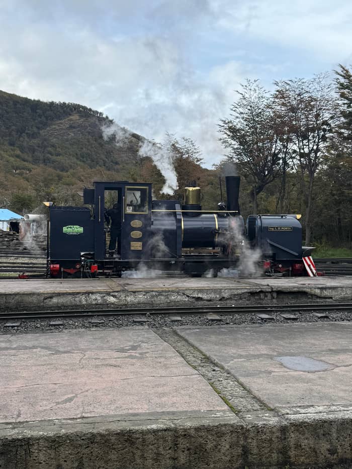
Most reviewed
Park and train classic
5 hours with guide
- Train1-hour ride
- StopsEnsenada, Lapataia, Lago Roca
- BreakAlakush centre
Explore the stops
The short version
After the End of the World Train, Tierra del Fuego National Park offers Ensenada Zaratiegui, Lago Acigami and Lapataia Bay, where the highway ends, plus short trails to a beaver dam and viewpoints.
Park facts
Discover 20 stops
Select a route, then press a pin or stop to read its note and open Google Maps.
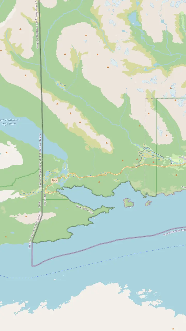
End of the line inside the national park; the train waits 10 to 15 minutes before heading back.
Google MapsCoastal site facing Isla Redonda and start of the Coastal Path.
Google MapsVisitor centre whose restaurant and café open from 10 to 17:30.
Google MapsLake Acigami, also called Roca, a binational lake crossed by the Chilean border.
Google MapsWhere National Route 3 ends; the sign gives 3,063 kilometres to Buenos Aires.
Google MapsLaguna Verde, on Isla Entre Ríos, is one of the park's basic campsites, without services.
Google MapsShort path to an old beaver dam: 20 minutes, 200 m, open all year.
Google MapsHigh-difficulty climb: 7:30 hours and 5 km return, open November to April.
Google MapsWaterfall trail of 30 minutes and 931 m, open November to April.
Google Maps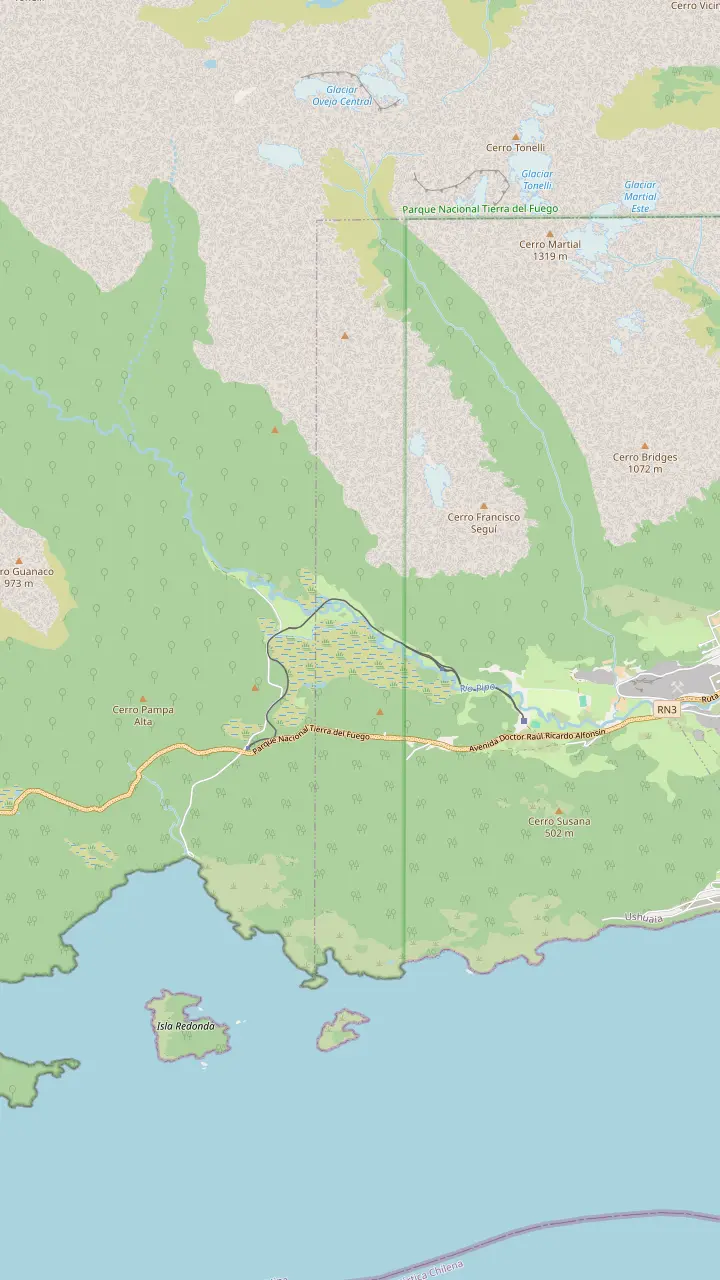
Main station on Route 3 at km 3065, about 8 km from the centre; the only place to board.
Google MapsThe halfway stop: about 20 minutes off the train, with a gazebo over the Pipo valley.
Google MapsThe waterfall where the prisoners' locomotive once took on water.
Google MapsFree camping area in the Pipo valley and start of the waterfall trail; the tracks run close by.
Google MapsWaterfall trail of 30 minutes and 931 m, open November to April.
Google MapsEnd of the line inside the national park; the train waits 10 to 15 minutes before heading back.
Google Maps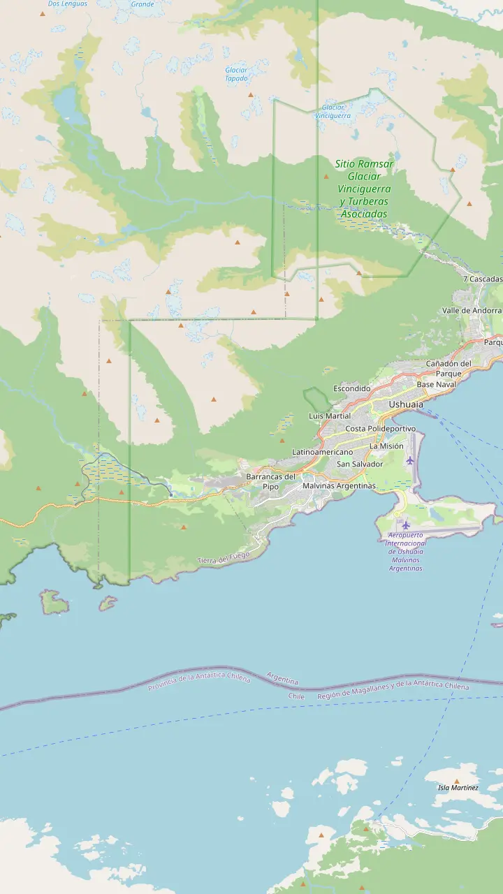
The convict-built prison, now the Maritime and Prison Museum; open 10:00 to 20:00.
Google MapsCapital of Tierra del Fuego province, at the southern tip of Patagonia.
Google MapsMain station on Route 3 at km 3065, about 8 km from the centre; the only place to board.
Google MapsThe halfway stop: about 20 minutes off the train, with a gazebo over the Pipo valley.
Google MapsEnd of the line inside the national park; the train waits 10 to 15 minutes before heading back.
Google MapsFree camping area in the Pipo valley and start of the waterfall trail; the tracks run close by.
Google Maps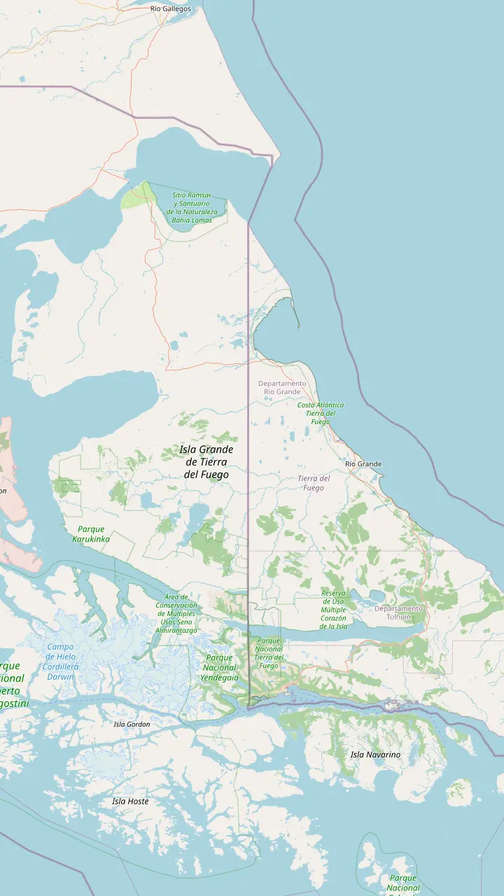
Capital of Tierra del Fuego province, at the southern tip of Patagonia.
Google MapsAirport 5 km from town; no public transport into the centre.
Google MapsWhere National Route 3 ends; the sign gives 3,063 kilometres to Buenos Aires.
Google MapsChilean town on Navarino Island that Chile's tourism board calls the southernmost city.
Google MapsA binational lake, like Acigami, crossed by the Chilean border.
Google MapsThe island's northern city; its airport lies about 5 km north-west of the centre.
Google MapsThe ferry crosses the Strait of Magellan, Chilean water, on the road to the island.
Google Maps© OpenStreetMap contributors · map data
The End of the World Train Tierra del Fuego ride ends where the national park begins. Here are the bays, lakes and short trails waiting after the platform, with fees and hours.
Editorial team, endoftheworldtrain.com · Updated November 11, 2026 · Takes 8 min
The End of the World Train Tierra del Fuego ride is really an overture: its last station stands inside the national park, and the park is what most visitors came for. The park's fact sheet dates it to 1960, created by Law 15,554, and the city tourism office gives its area as 68,909 hectares of sea coast, forest and mountain together.1,2 Ushuaia lies 12 km away, close enough for a half-day visit.8
The park protects the last stretch of the Andes where it meets the Beagle Channel. Its forests are mostly lenga, which turns a deep red in autumn, mixed in wetter places with canelo and guindo that keep their leaves all winter.9,10 The operator's park page adds peat bogs, rivers and the north shore of the channel to that list.11 From the train you see the forest; after the train you reach the water.
People were here long before rangers. The city tourism office says the shell middens in the park show the land has been inhabited for more than 10,000 years.12 The park service's own heritage page dates the occupation sites it has studied to about 1,800 years before the present.13 The Yamana, the canoe people of the channel, left their language in the names of many places you will visit.
Trail planner
| Trail | Time | Distance | Open |
|---|---|---|---|
| Castorera | 20 minutes | 200 m | All year |
| La Baliza | 30 minutes | 1200 m | All year |
| Mirador Lapataia | 30 minutes | 980 m | All year |
| Río Pipo waterfall | 30 minutes | 931 m | November to April |
| Hito XXIV | 2 hours each way | 3 km each way | November to April |
| Costera | 4 hours each way | 8 km each way | November to April |
| Cerro Guanaco | 7:30 hours return | 5 km return | November to April |
All times, lengths and seasons from the national park service's trail list.20,26,27,28,29,30,31
Ensenada Zaratiegui is often the first stretch of sea a park tour reaches after the train. The park service describes it as a coastal site facing Isla Redonda and the starting point of the Coastal Path.15 The operator's park page calls it a refuge for bird watching and for protecting archaeological heritage.6 A small post office stands by the pier, so allow a little extra time if you want to send a card home from the bay.
The bay has a beach, but no services and very cold water, so it is for looking rather than swimming.21 The Coastal Path from here runs for 8 kilometres along the Beagle and takes about 4 hours one way, according to the city tourism office.22 A shorter forest walk links Route 3 with Ensenada in 40 minutes over 1300 m, open from November to April.23 Either makes a good stretch of the legs after the train.
Ensenada is also a seasonal place. One park and train tour's listing says the Ensenada Zaratiegui area is closed in the winter season, so a July tour may skip it. The Pampa Alta walk can be reached from the bay, 4.9 km from that side or 3.7 km from Route 3, and ends at a view over the channel, the Pipo valley and Cerro Guanaco.24,25 That makes it a fine add-on on a long summer day, when the light lasts well into the evening and the forest floor is dry enough to enjoy.
Lago Acigami, long known as Lago Roca, is the park's big lake, and it crosses into Chile. The city tourism office says Acigami, like Lake Fagnano, is a binational lake cut by the border.16 Walking about 3.5 kilometres along its north-west shore brings you to milestone XXIV, the marker on the Argentina-Chile line.32 The park service rates the Hito XXIV path medium, at 2 hours and 3 km each way.29
The lake is also the start of the park's toughest day walk. Cerro Guanaco is a high-difficulty climb of almost 4 kilometres on steep slopes, about 4 hours to a summit with views of the Fuegian range and the Beagle Channel, says the city.33 The park service lists it at 7:30 hours and 5 km return, open from November to April only.31 Keep in mind that the climb closes in winter.34
At the other end, the lake gives birth to the Lapataia river.35 Organised trips in inflatable canoes are allowed on Lake Acigami, the Lapataia river and part of Lapataia Bay, and nowhere else in the park.36 Nearby, Alakush, the visitor centre, serves meals and coffee between 10 and 17:30.17 It is the natural lunch stop on a park day, with exhibits on the park's history inside and a warm room when the wind picks up off the lake.
Choose your park day
Pick by time, budget and how much you want to walk.
If Just a taste with the ride
The site's 4.5-hour tour
It includes 30 minutes in the park and 30 at Lapataia.
If The classic bays and lakes
The 5-hour park and train tour
It stops at Ensenada, Lapataia, Lago Roca and Alakush.
If Park plus the Beagle Channel
The 8.5-hour full day
A channel boat follows the park visit.
If A real hike
Ride one way, walk the Costera
The coastal path is 8 km, about 4 hours one way.22
If Wildlife on a short walk
The Castorera path
An old beaver dam in 20 minutes.20
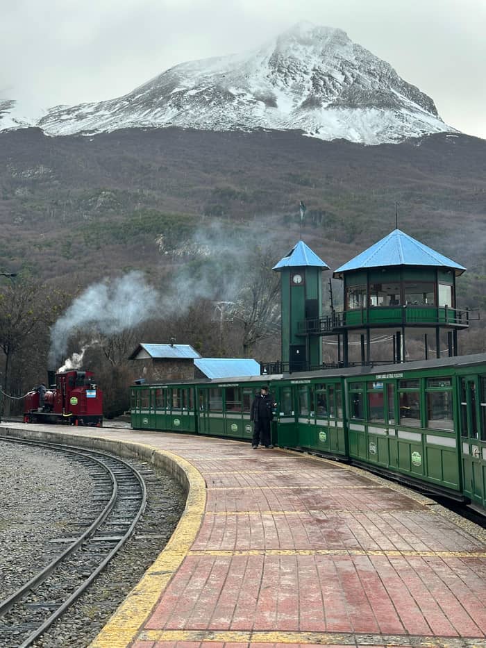
Train and park tours
Most reviewed
5 hours with guide
Shorter day
4.5 hours with guide
Full day
8.5 hours with guide
Lapataia is the name that sticks. In the city tourism office's telling, the name is Yamana for the forest bay.64 The park's fact sheet calls Lapataia Bay the only Argentine fjord on the Beagle Channel.65 It is also where National Route 3, the long road down the length of Argentina, finally ends inside the park.7 The sign is the classic photo stop, and the boardwalks start right beside it.
That sign counts 3,063 kilometres back to Buenos Aires, the city tourism office notes.19 Around it, raised boardwalks protect archaeological sites while giving an accessible walk with viewpoints along the way.18 Short paths start nearby. Mirador Lapataia crosses forest and peat bog in 30 minutes and 980 m, and La Baliza runs from the boardwalks to the sea in 30 minutes and 1200 m, both open all year.27,26
The bay was a workplace too. The park service records remains of a charcoal kiln, a canning factory and an old ranch at Lapataia.66 It also lists timber works near the channel from the early twentieth century to 1960, the same era as the prisoners' railway.67 A day that links the End of the World Train, Ensenada and Lapataia Bay therefore follows the island's story from convict logging to protected wilderness, all inside one valley and one coast.
After the platform
Park station
10 to 15 minutes before the train turns back.14
Ensenada
Coastal site facing Isla Redonda.15
Lago Acigami
A binational lake shared with Chile.16
Alakush
Restaurant and café from 10 to 17:30.17
Lapataia
Castorera
A 20-minute walk on the way out.20
The most surprising wildlife story in the park is an unwanted one. The national biodiversity database says the beaver reached the Argentine half of the island in 1945-1946, brought in for its fur, and 25 pairs from Canada were released near Lake Fagnano.68,69 They reached the national park in 1960 and now occupy much of it.70 A single dam may stand 5 m tall.71 What looks like a charming animal story is, for the forest, an invasion: Argentina lists the beaver as an invasive species under compulsory control.72
You can see the damage on a short walk. The Castorera path runs from Route 3 to an old beaver dam through forest in 20 minutes and 200 m, open all year.20 The database estimates some 6000 colonies in the Argentine sector, affecting over 5200 ha of forest.73 Their dams flood large areas of woodland and kill the trees, leaving the grey drowned stands you will notice along streams.74 Once you know the signs, you spot them from the van window all over the valley.
The native animals are gentler. The park's emblem is the kelp goose, which lives along the sea coast and feeds on seaweed; the male is white with a black bill and yellow legs.75,76 Guanaco, the southern river otter and the Fuegian red fox live in the park.77 On the trails it is common to meet foxes and hear a woodpecker drumming.78 Never feed or disturb any of them; the rules forbid it.63
Video
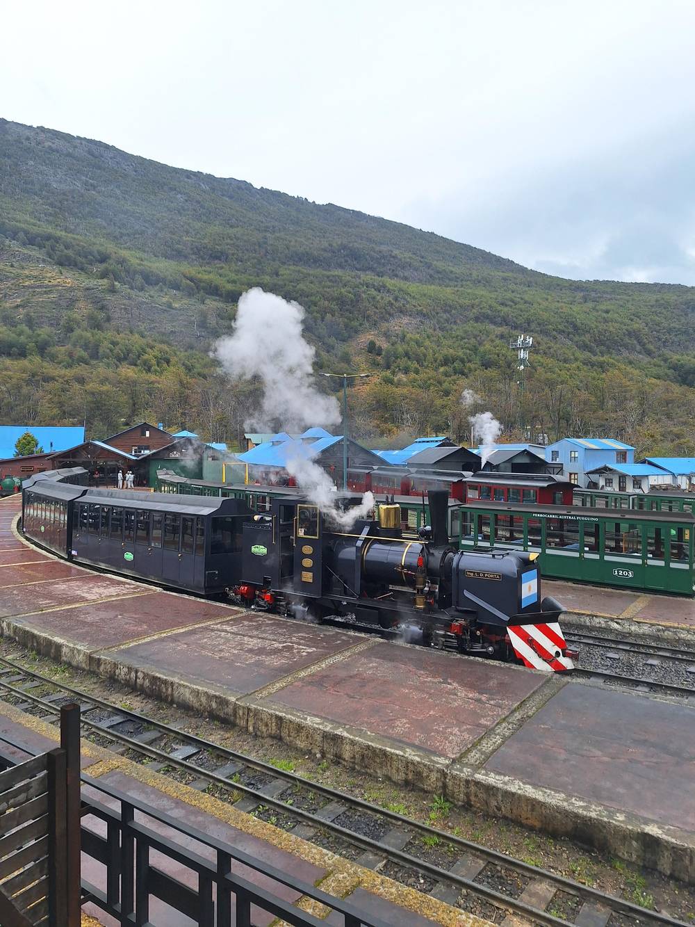
Pat's Adventures on YouTube · The video stays unloaded until you press play.
The park protects 68,909 hectares and is the only one in the Argentine Republic that combines marine, forest, and mountain environments
Park day kit
The park charges its own entry, separate from the train. The operator is clear that its fare does not cover the park, and that the park ticket is required to ride.57 From 1 June 2026 the park's general rate is ARS 40,000, with ARS 18,000 for Argentine residents.3,4,79 Children from 0 to 6 years inclusive go in free.80 Check the park's fee page before you travel, as rates change, and ask whether your tour price already covers the entry.
The park's printed visitor leaflet adds a seasonal twist: the fee is collected at the gate in high season, October to April, and waived the rest of the year.81 Opening hours follow the light: from December to February the gates run 8:00 to 21:00; in March, October and November they shut at 20:00 after an 8:00 start; from April to September the day is 9:00 to 18:00.82,83,58 Drivers must keep to 40 km/h inside the park.84 Watch for rabbits, foxes and guanacos stepping onto the gravel, so take it slowly even when the road looks empty.85
A few rules shape the day. There are no rubbish bins in the park, so carry your waste back out.60 Pets are not allowed, and neither are drones or any other overflights.61,62 River and lake water is not safe to drink, so bring your own.59 Late in summer, watch your food for the exotic yellowjacket wasp, which the park singles out as a nuisance.86 Leave no trace and the next visitor finds the same quiet forest you did.
There are several ways to combine the ride and the park, depending on your budget and how much you like to walk. You can ride out one way, walk, and hope for room on the 16:00 return in spring or summer.87 You can drive or take the regular shuttle, which leaves from Maipú Avenue and Juana Fadul without a guide.88 Or book a guided day that pairs the End of the World Train and Ensenada Bay with the rest of the park, transport included.
The most reviewed of those tours lists a 1-hour train ride, then Ensenada Zaratiegui, Lapataia Bay and Lago Roca, with a break at the Alakush centre, in 5 hours, from $105. This site's own tour keeps it shorter at 4.5 hours, with a park stop and a Lapataia stop of 30 minutes each around a 1-hour ride, from $180. A longer day finishes on the water with a Beagle Channel cruise, 8.5 hours in all, from $190.
Budget tours exist too. One park tour lists the train as optional and says the park entrance ticket is not included, with prices from $49. Whatever you pick, ask if the park entry is already covered, which way the train is ridden and how long you get at Lapataia. Those answers decide whether the day feels rushed or relaxed. A tour with more stops is not always better: a longer pause at Lapataia can beat a quick tick-list of viewpoints.
FAQ
Its last platform lies within the park boundary.42
The park sells its own ticket, and you need it to ride.57
National Route 3 continues inside the park and ends at Lapataia Bay.7
The name comes from the Yamana language.64
A 20-minute, 200 m walk from Route 3, open all year.20
Overflights, drones included, are banned across the park.62
Sources
Related guides
Riding the old prison line into the park? Ask a real person here.