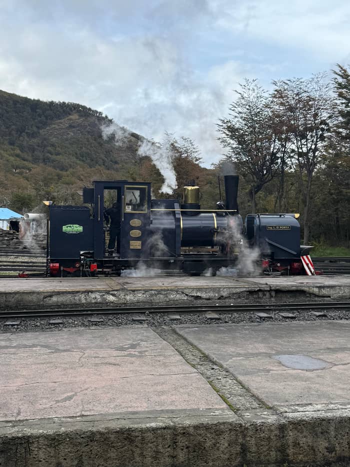
End of the road
Lapataia Bay
Inside the national park
- RoadNational Route 3 ends
- Sign3,063 km to Buenos Aires
- NameThe forest bay
Explore the stops
Discover 20 stops
Select a route, then press a pin or stop to read its note and open Google Maps.
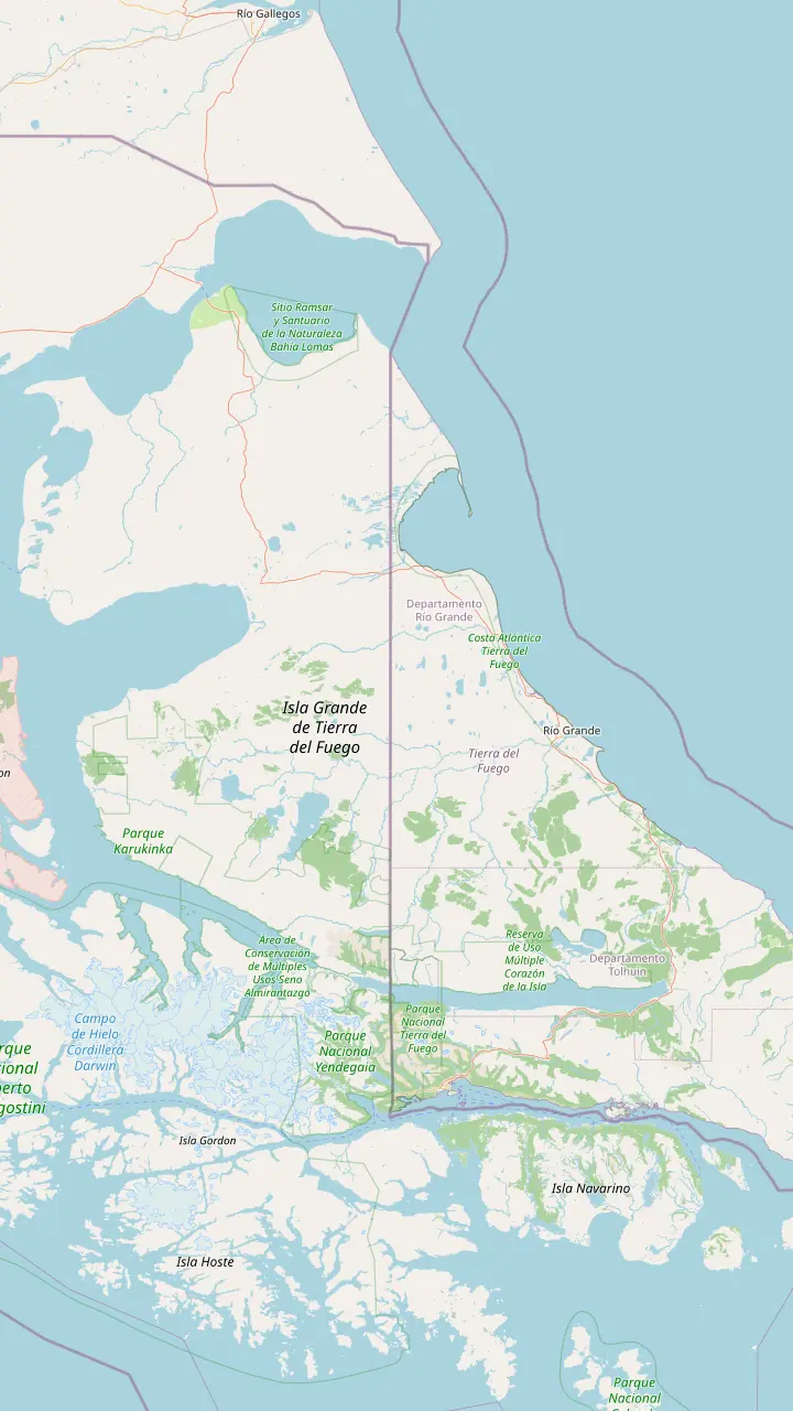
Capital of Tierra del Fuego province, at the southern tip of Patagonia.
Google MapsAirport 5 km from town; no public transport into the centre.
Google MapsWhere National Route 3 ends; the sign gives 3,063 kilometres to Buenos Aires.
Google MapsChilean town on Navarino Island that Chile's tourism board calls the southernmost city.
Google MapsA binational lake, like Acigami, crossed by the Chilean border.
Google MapsThe island's northern city; its airport lies about 5 km north-west of the centre.
Google MapsThe ferry crosses the Strait of Magellan, Chilean water, on the road to the island.
Google Maps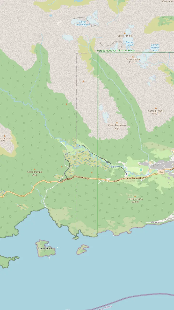
Main station on Route 3 at km 3065, about 8 km from the centre; the only place to board.
Google MapsThe halfway stop: about 20 minutes off the train, with a gazebo over the Pipo valley.
Google MapsThe waterfall where the prisoners' locomotive once took on water.
Google MapsFree camping area in the Pipo valley and start of the waterfall trail; the tracks run close by.
Google MapsWaterfall trail of 30 minutes and 931 m, open November to April.
Google MapsEnd of the line inside the national park; the train waits 10 to 15 minutes before heading back.
Google Maps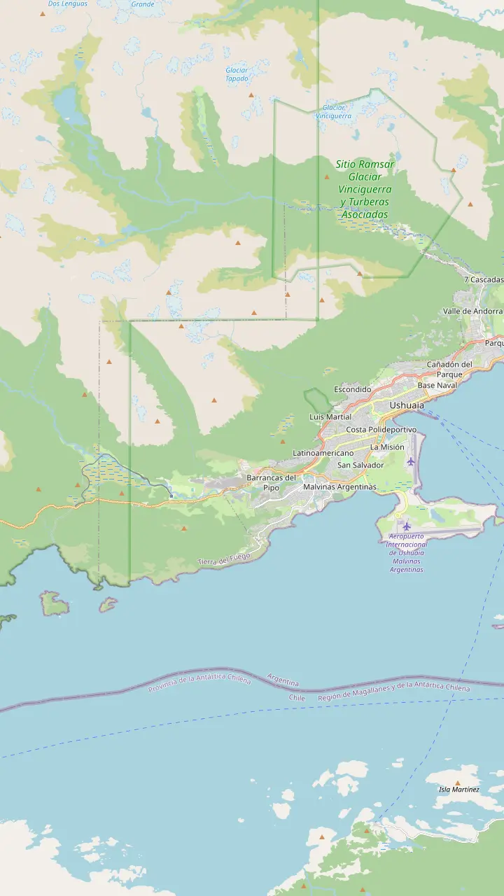
The convict-built prison, now the Maritime and Prison Museum; open 10:00 to 20:00.
Google MapsCapital of Tierra del Fuego province, at the southern tip of Patagonia.
Google MapsMain station on Route 3 at km 3065, about 8 km from the centre; the only place to board.
Google MapsThe halfway stop: about 20 minutes off the train, with a gazebo over the Pipo valley.
Google MapsEnd of the line inside the national park; the train waits 10 to 15 minutes before heading back.
Google MapsFree camping area in the Pipo valley and start of the waterfall trail; the tracks run close by.
Google Maps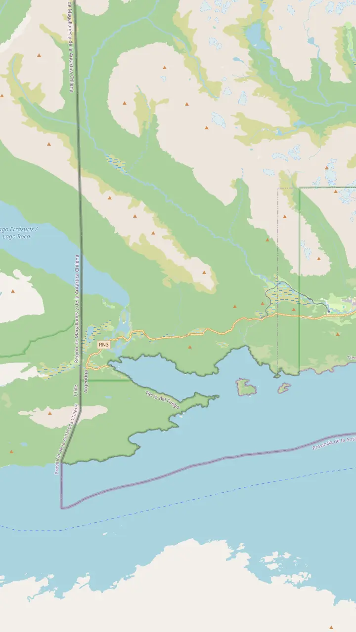
End of the line inside the national park; the train waits 10 to 15 minutes before heading back.
Google MapsCoastal site facing Isla Redonda and start of the Coastal Path.
Google MapsVisitor centre whose restaurant and café open from 10 to 17:30.
Google MapsLake Acigami, also called Roca, a binational lake crossed by the Chilean border.
Google MapsWhere National Route 3 ends; the sign gives 3,063 kilometres to Buenos Aires.
Google MapsLaguna Verde, on Isla Entre Ríos, is one of the park's basic campsites, without services.
Google MapsShort path to an old beaver dam: 20 minutes, 200 m, open all year.
Google MapsHigh-difficulty climb: 7:30 hours and 5 km return, open November to April.
Google MapsWaterfall trail of 30 minutes and 931 m, open November to April.
Google Maps© OpenStreetMap contributors · map data
Where is Ushuaia? On the south coast of Tierra del Fuego, an island shared with Chile, facing the Beagle Channel. It belongs to Argentina and sits at the tip of Patagonia.
Editorial team, endoftheworldtrain.com · Updated November 11, 2026 · Takes 8 min
Where is Ushuaia? It is the capital of Argentina's Tierra del Fuego province, whose full title also takes in Antarctica and the islands of the South Atlantic, according to the city's tourism office.1 The city stands on Tierra del Fuego, an island that the Strait of Magellan keeps apart from the mainland, shared by Argentina and Chile.2 Ushuaia is on the Argentine side, so you arrive in Argentina, not Chile, and use pesos rather than Chilean money.
Its setting is the south coast of that island, where the last ridges of the Andes drop into the Beagle Channel. The national parks service describes the channel as the link between the Atlantic and the South Pacific oceans.5 That puts the town between mountains at its back and open water in front, a squeeze of land that explains its long, narrow shape along the shore and the steep streets that climb from the port toward the forest.
Distances make the location real. Tierra del Fuego's tourism board puts 3,079 kilometers between Ushuaia and Buenos Aires, but only 1,000 kilometers between the city and the Antarctic Peninsula.4 In other words, the city is closer to Antarctica than to its own national capital by a wide margin. The flight from Buenos Aires takes about 3 hours, the city tourism office says, so the far south is a lot easier to reach than the map suggests.6
Southernmost claims
| Claim | Who says it | Basis |
|---|---|---|
| Ushuaia, southernmost city | Argentina's park service | The capital, 12 km from the park |
| Puerto Williams, southernmost city | Chile's tourism board | Navarino Island settlement |
| End of the World Train | Argentina's park service | Southernmost train on the planet |
| Malvinas Argentinas airport | Argentina's park service | Southernmost air terminal |
| Cerro Castor | Argentina's park service | Southernmost ski centre |
Each line quotes the official body named; the claims do not measure the same thing.18,20,21,22,23,24
Is Ushuaia in Patagonia? Yes. The city's tourism office places Ushuaia at Patagonia's southern tip, the point where Argentina runs out.3 The national parks service files Tierra del Fuego National Park, just outside town, under its Southern Patagonia region.13 So in both official geography and everyday speech, Ushuaia is Patagonian, even though it sits across the water from the mainland and has to be reached by plane, by ship or by a ferry over the Strait.
The island question is what confuses people. The province is the youngest in Argentina and the only one that is an island, the city's travel page notes, and the Strait of Magellan between it and the mainland belongs to Chile.14,15 On a map, Patagonia reads as the whole southern cone below the rivers of the pampas, and Tierra del Fuego is simply its last, detached piece, the place where the continent finally breaks up into islands and channels.
The province is also young as a political unit. Tierra del Fuego was recognised as an Argentine province only in 1991, says the national parks service, after a long life as a national territory.12 Its claimed territory reaches far beyond the island: the province's map also includes an Antarctic sector claimed by Argentina and islands in the South Atlantic.16 That reach is part of why Ushuaia thinks of itself as a gateway.
Chile is never far from Ushuaia. The provincial tourism board measures the Argentine share of the island, Isla de los Estados included, at 21,571 square kilometers.29 Driving in from the mainland means crossing two borders with Chile, because the road runs through Chilean land on both sides of the Strait.25 After a ferry of half an hour you land at Bahía Azul, still in Chile.26 Carry your passport and car papers, because both countries check them.
From the San Sebastián border post, back in Argentina, Ushuaia is still 293 km away.30 Inside the national park the border is close enough to walk to. Lake Acigami, also called Roca, is a binational lake cut by the Chilean line, like the much larger Lake Fagnano.31 A trail of about 3.5 kilometres along its shore ends at milestone XXIV, the boundary marker.32 The park service rates that path medium, about 2 hours each way, and it brings you to an international frontier with the lake beside you.33
Across the Beagle Channel the neighbour is Chilean too. The city tourism office notes that from the far side of the channel near Puerto Almanza you can see Puerto Williams, a small town belonging to Chile.34 The towns face each other across the same water, which is the setting for the friendly rivalry over which of them is the southernmost city. The map on this page shows both, with the national park in between.
Plan the trip
Choose the route that matches your time and taste.
If I have a short trip
Fly from Buenos Aires
About 3 hours to Ushuaia.6
If I love road trips
Drive south through Chile
If I am heading to Antarctica
Sail from Ushuaia's port
The city counts thousands boarding from November to April.27
If I want to see the end of the road
Lapataia Bay
Route 3 ends inside the national park.28
Ends of the world
End of the road
Inside the national park
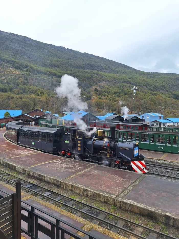
Hard to reach
Isla de los Estados
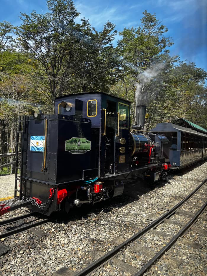
Across the channel
Navarino Island, Chile
Why is Ushuaia called the end of the world? The plainest reason is geography: the city's tourism office says it sits at the southern tip of Patagonia, where Argentina itself ends.3 The office adds that people call it the end of the world, though some would rather say the beginning of everything.57 Both slogans appear on signs, souvenirs and the city's own pages, and you will find them printed on mugs, postcards and the hoardings along the waterfront.
The road agrees. National Route 3, the long highway down Argentina, runs into the national park and ends at Lapataia Bay.28 A signpost there puts Buenos Aires 3,063 kilometres away.48 The End of the World Train runs out to the same park, so the phrase follows you from the platform to the last metre of asphalt. The train borrowed the name; the place had it first, and the signpost photo is the souvenir that proves you reached it.
There is also a lighthouse at the end of the world, though not where people think. The city explains that the End of the World Lighthouse is out on Isla de los Estados, over 200 kilometers away, while the striped tower on the Beagle Channel tours is Les Eclaireurs, about 20 kilometres away.19 An exact replica of the real lighthouse stands at the Maritime Museum in the old prison.58
How the town grew
Long ago
Canoe people living by the channel.7
12 October 1884
The Argentine state founds Ushuaia's subprefecture.8
1896
A decree plans a penal colony on the island.9
1902
The foundation stone of the prison is laid.10
1947
Closed by presidential decree on 21 March.11
1991
Tierra del Fuego becomes an Argentine province.12
Ushuaia's own institutions use the superlative freely. The national parks service calls it the southernmost city in the world, 12 km from the park.18 The same service calls the End of the World Train the southernmost on the planet and Malvinas Argentinas airport the southernmost air terminal in the world.22,23 It also describes Cerro Castor, 26 km from the capital, as the southernmost ski centre in the world.24
Chile tells it differently. Its national tourism board calls Puerto Williams the southernmost city in the world.20 The same page says Puerto Williams, on the south of Navarino Island, holds the title of the southernmost human settlement on the planet.21 Both statements come from official tourism bodies, and which one you accept depends on what you are willing to call a city. Visit both and you can claim the record either way.
For a traveler the argument matters less than the view. Standing on Ushuaia's waterfront you look south across the channel toward the Chilean islands and the open ocean beyond them. Ushuaia calls itself the gateway city to Antarctica, 1000 km off, and counts 90% of Antarctic tourist voyages as calling at its port first.59 That is the claim nobody disputes, and on a summer morning you can watch the expedition ships load in the bay.
Video
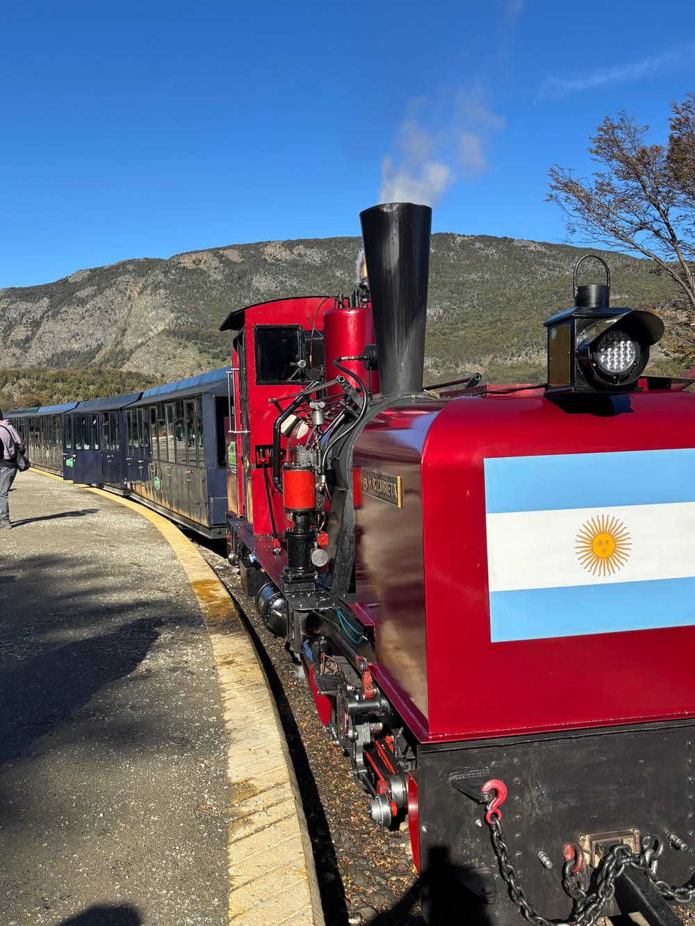
MemorySeekers on YouTube · The video stays unloaded until you press play.
Ushuaia is located at the southern tip of Patagonia, marking the end of Argentina
Before you go
Tierra del Fuego means land of fire, and the name comes from the people who lived here. The city tells the legend that the first European navigators saw columns of smoke rising along the shore and named the island after them.60 The national parks service says the fires had burned for more than 10,000 years, and that navigators such as Magellan, Gaboto and Darwin used the name.61 The island's name is a record of other people's camps, seen from passing ships.
Those fires belonged to several peoples. The city lists the Selknam or Onas, the Haush, the Alakalufes and the Yamana as the island's earlier inhabitants.62 The train operator describes the Yamana as a canoe people who lived along the channel for thousands of years, mainly by hunting sea lions.7 Their language survives in the place names visitors use every day around Ushuaia, often without knowing it, on bus timetables, trail signs and tour menus.
The Beagle Channel is also called the Onashaga, which in the Yaghan language means hunters' channel.63 Lapataia, the bay at the end of the highway, translates from Yamana as the bay of the forest.64 The city's own trail page pairs Acigami with Roca and Khami with Fagnano, using both names side by side.31 Learning them is a small way to see the island as its first people did, and guides are usually happy to explain the older names.
Flying is the usual way in. The city tourism office gives about 3 hours of flying from Buenos Aires, landing at Malvinas Argentinas International Airport, 5 km from town.6,17 The national parks service measures it at 4 km south of the city.23 Buses do not serve the airport, so the choice is a taxi, a remise or a pre-booked transfer.53 Book that ride before you land if your flight arrives late in the evening.
Driving is the adventure route. You cross the Strait of Magellan by ferry and pass through Chile, then cross back into Argentina before the long run south to Ushuaia.15,25 Tierra del Fuego has a zero-tolerance rule on drinking and driving, so keep the celebrations for when the car is parked.55 Allow spare time for the ferry and the border queues, which can vary with weather and season.
Many arrive by sea. From November to April, the city says, thousands of travelers board Antarctic expedition ships in Ushuaia's port.27 If you are one of them, the city is worth an extra day before sailing: the national park and the End of the World Train sit just west of town, and the old prison museum tells the story of how this remote corner was settled. Whichever way you come, the map soon makes sense once you are standing on the shore.
FAQ
The city's tourism office places it at the southern tip of Patagonia.3
It sits at Patagonia's southern tip, where the country itself runs out.3
Provincial tourism gives 1,000 kilometers to the Antarctic Peninsula.4
That is the provincial tourism board's figure.4
Sources
Related guides
Riding the old prison line into the park? Ask a real person here.